Alaska’s Source Group provides the most comprehensive underground locate services available.
Cable faults, cable locates, pipe camera inspections, ground penetrating radar, gps mapping, etc … for commercial, public and private entities.
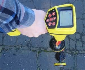
For final design, and early construction phases of a project, Alaska’s Source excavates test holes to determine the exact horizontal and vertical location of existing utilities, in the highly case sensitive area’s.
Our services for this task include;
-
Acquisition of any required permits to perform vacuum excavation
-
Detailed investigation of any available records, plans, and maps
-
Field staking of the exact location of the proposed features in possible conflict with existing utilities
-
Location of existing buried utilities or any other structures that may conflict with proposed construction
-
Non-destructive, vacuum excavation test hole to expose the utility at all points of possible conflict
-
Restoration of the test hole and marking of the location utilizing established utility designating color codes and ASCE Standards of practice
-
Formal test hole report and inventory detailing all structures and utilities found
-
Total station exhibit of the test hole locations for CADD mapping of project site
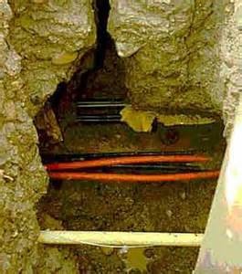
TEST HOLE EXCAVATION
Alaska’s Source is a professional firm that provides services to planners, engineers, surveyors, private ventures, and construction industry professionals.
How much does it cost?
The cost of service depends on a wide variety of factors including but not limited to the quality level of data desired, the number and density of utilities present, the availability of existing utility records, the project area and geography, geophysical site conditions and the desired degree of survey documentation.
According to industry sources, the costs of locating at sufficient locations to identify critical utility conflicts are about 1% of a typical highway and construction budget or about 10% of a typical highway design budget. The cost in urban areas are greater than in rural areas. 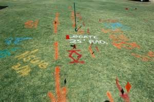
What products do I get?
Alaska’s Source produces documentation of the results of its work in suitable formats that vary in formality. Hand drawn sketches and documentation are routinely created to record the results of field investigations.
For design purposes, the field data is also collected using conventional and GPS based survey instruments and then converted to digital map using CAD software and techniques, CAD files are submitted to the client and or engineering.
What are the benefits?
- Reduction in unforeseen utility conflicts and relocations
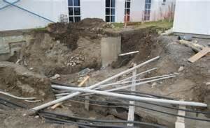
- Reduction in delays due to utility cuts
- Reduction in project delays due to utility relocates
- Reduction in claims and change orders
- Improvement in contractor productivity and quality
- Reduction in utility companies cost to repair damaged facilities
- Increased efficiency of surveying activities by elimination of duplicate surveys
- Inducement of savings in risk management and Insurance
- Project awareness alaskassource@gmail.com
What is SUE? 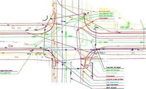
Subsurface utility engineering, or SUE, is a branch of engineering practice that involves managing certain risks associated with utility mapping at appropriate quality levels, utility coordination, utility relocation design, coordination, utility condition assessment, communication of utility data to concerned parties, utility relocation cost estimates, implementation of utility accommodation policies, and utility design.
Is there a Standard Practice?
- The American Society of Civil Engineers adopted CI/ASCE 38-02
- The Standard Guidelines for the Collection and Depiction of Existing Subsurface Utility Data (ASCE 38-02) in 2002.
It is our practice to conform to it when providing service to our clients.
Who is qualified to provide SUE?
According to Federal Highway Administration, SUE expertise should be evaluated on the basis of competence, experience, equipment, timeliness, financial capacity and insurance capabilities. 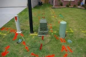
For more information on how to have us
